News & Events
US EPA Releases Beta Version of AERSCREEN
The US EPA released a beta version of the AERSCREEN model on August 17, which can be downloaded from the SCRAM website. AERSCREEN is a screening tool, based on the AERMOD model, which is designed to estimate worst-case 1-hour concentrations for a single source. Conversion factors also allow AERSCREEN to estimate 3-hour, 8-hour, 24-hour, and annual concentrations. AERSCREEN utilizes a tool called MAKEMET to generate a matrix of worst-case meteorological conditions, eliminating the need for user-provided met files.
The comment period for this beta release will end on September 17, 2010, and a final release is expected by the end of the year. Lakes Environmental is currently developing an interface for the AERSCREEN tool. Further announcements will be coming soon.
US EPA Clarification Memo on 1-Hour S02 NAAQS
On August 23, the US EPA released a clarification memo on the SCRAM website regarding "Applicability of Appendix W Modeling Guidance for the 1-hour SO2 NAAQS" has been released in conjunction with "Guidance Concerning the Implementation of the 1-hour SO2 NAAQS for the Prevention of Significant Deterioration Program".
Lakes Environmental Releases AERMOD View™ Version 6.7.1
Lakes Environmental is pleased to announce the release of AERMOD View Version 6.7.1., the latest release of its air dispersion modeling software. With this latest version of AERMOD View come new features including:
- Graphical Copy and Paste - Sources can be copied and pasted from the graphical display
- Warnings at Run Time – AERMOD View gives warnings at run time as well as errors
- Source Inputs Dialog - The source inputs dialog has been updated to make the use of differentunits even easier
For a comprehensive list of the updates and new features available in AERMOD View version 6.7.1, please see our latest release notes.
If you are currently in maintenance for AERMOD View and did not receive an email regarding this update, please contact us at support@weblakes.com.
If you are a user of AERMOD View but are no longer in maintenance please contact sales@weblakes.com to find out how you too can begin using version 6.7.1!
Lakes Environmental Releases AERMOD View™ Version 6.6
Lakes Environmental is proud to announce the immediate release of AERMOD View Version 6.6., the latest release of its most popular air dispersion modeling software. With the latest version of AERMOD View come new features including:
- Support for SO2 National Ambient Air Quality Standards (NAAQS) - calculating the 3-year average of the 99th percentile of the annual distribution of daily maximum 1-hour average concentrations
- Support for PM2.5 NAAQS – calculating the highest average of the maximum 24-hour averages across 5 years of data
- Automatic BPIP Runs - automatically run BPIP when AERMOD is run
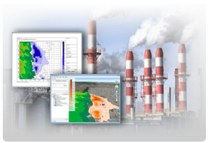 For a complete list of the updates and new features available in AERMOD View version 6.6, please see our latest release notes.
If you are currently in maintenance for AERMOD View and did not receive an email regarding this update, please contact us at support@weblakes.com.
If you are a user of AERMOD View but are no longer in maintenance please contact sales@weblakes.com to find out how you can get up and running on this latest release!
US EPA Memorandum on NO2 NAAQS
On June 28, 2010, the US EPA Air Quality Modeling Group released a memorandum which clarifies the applicability of current guidance in the Guideline on Air Quality Modeling for modeling NO2 impacts in accordance with the Prevention of Significant Deterioration (PSD) permit requirements to demonstrate compliance with the new 1-hour NO2 standard.
This memorandum can be reviewed on the US EPA’s SCRAM website.
Lakes Environmental at A&WMA 2010 Conference & Exhibition

Lakes Environmental would like to thank everyone who stopped by our booth in Calgary at A&WMA’s 103rd Annual Conference and Exhibition from June 22-24. We hope you enjoyed your time at this year’s conference and look forward to assisting you in your endeavors throughout the coming year. See you in 2011 at A&WMA’s conference in Orlando, Florida!
Visitors to our booth had the chance to participate in a draw for a free copy of our AERMOD View or CALPUFF View software packages.
We would like to take this opportunity to offer our congratulations to our AERMOD View software winner, C.C. from California and our CALPUFF View software winner, B.S. from Alberta. Happy modeling!
Our winners requested that their names and company names not appear in this Newsletter.
AUSTAL & ARTM Courses in Beijing, China
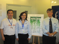
On July 6 to 8, 2010, Dr. Jesse The', president of Lakes Environmental, was in Beijing teaching a 2-day AUSTAL course and a 1-day ARTM course. Both courses included a combination of theory and hands-on case studies using Lakes Environmental's advanced graphical user interfaces: AUSTAL View and ARTM View.
The AUSTAL and ARTM air dispersion modeling courses courses were organized and promoted by our distributor in China, SinoCAN Intellitech.
 AUSTAL (AUSTAL2000) is a Lagrangian particle tracking air dispersion model and it is the official model for the German Federal Environmental Agency (UBA).
ARTM is the German Federal Office for Radiation (BfS) official model and it is the new standard for the dispersion and deposition calculation of airborne radioactive materials according to the German Nuclear Act. The ARTM model is based on the "TA Luft" and the "AUSTAL2000 model".
Course attendees were able to complete a series of case studies involving cooling tower modeling, odor modeling, and radiation modeling among others.
CALRoads View™ Version 4.0 Released
Lakes Environmental is pleased to announce the release of CALRoads View 4.0 on June 3, 2010.
Some of the new features include:
- Export to Google Earth™ - Export your modeling project to Google Earth to clearly envision your input data and results and dramatically improve communication
- New Project Wizard – takes you step-by-step through initial project setup options for creating a new project
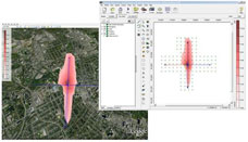 Please see the release notes for a complete list of the changes and new features available in CALRoads View Version 4.0.
If you are currently in maintenance for CALRoads View and did not receive an email regarding this update, please contact us at support@weblakes.com.
If you are a user of CALRoads View but are no longer in maintenance please contact sales@weblakes.com to find out how you can get up and running on this latest release!
US EPA PM2.5 Memorandum
On March 23, 2010, the US EPA Office of Air Quality Planning and Standards (OAQPS) released a memorandum discussing dispersion modeling procedures used to demonstrate compliance with the PM2.5 National Ambient Air Quality Standards (NAAQS) - "Modeling Procedures for Demonstrating Compliance with PM2.5 NAAQS".
The memorandum states that when modeling either the initial Significant Impact Analysis (SIA) or the Cumulative Impact Analysis (CIA), the following PM2.5 averaging values should be calculated:
- Annual Standard: The highest average of the modeled annual averages across 5 years of National Weather Service (NWS) meteorological data or the highest modeled annual average for 1 year of site-specific meteorological data.
- 24-Hour Standard: The highest average of the maximum 24-hour averages across 5 years of NWS meteorological data or the highest modeled 24-hour average for 1 year of site specific meteorological data.
Please see below this month's modeling tip for details on how these values can be calculated using the AERMOD model.
New Knowledgebase for Lakes Environmental Freeware Products!
New Look, Easier Navigation, New Articles...
Lakes Environmental is proud to introduce our new Freeware Knowledgebase, which can be found on our web site. This knowledgebase will be dedicated to our current freeware product offerings: WRPLOT View, Screen View, and Percent View and will provide a wealth of information to the users of these tools.
General information about each freeware product will be available as well a constantly expanding library of FAQ’s (Frequently Asked Questions). Our online knowledgebase is available 24/7/365 meaning that even those customers across the world will always have access to the information they need, when they need it. Try it out today!
Product Spotlight - FETS-RT Web™
Facility Emissions Tracking System - Real Time
FETS-RT Web is a fully customizable,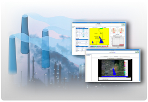 web-based software solution which allows facilities to monitor and model their air emissions in real-time.
FETS-RT Web seamlessly interfaces with real-time monitoring equipment to alert the user of any observed concentrations which may exceed permitted thresholds. At the same time, FETS-RT Web provides continuous air dispersion modeling to predict when an exceedance might occur over the next 24 hours. FETS-RT Web uses a combination of real-time data from stack emission measurements, ambient monitoring stations, and meteorological station data in conjunction with forecast meteorology to run air dispersion modeling and determine the predicted impacts.
FETS-RT Web is a breakthrough environmental compliance solution allowing you to manage emergency scenarios, assist in demonstrating regulatory compliance, and perform culpability analysis. All of these functions can be performed using our dynamic, user-friendly interface which provides critical emissions and modeling information to operators, engineers, and site supervisors. These powerful capabilities make it possible for the first time to proactively evaluate mitigation strategies, evaluate alternate control options, and quantify potential off-site impacts up to 24 hours in advance.
Key Features:
- Pollutant impact forecasts generated every 5 minutes
- Air dispersion modeling performed using CALPUFF
- An intuitive ‘alarm system’ alerts users to any active or potential issues with concentration levels, forecasts, and data quality
- Comprehensive reports listing predicted meteorological conditions and potential impacts
- Graphing capabilities including displays of major source contributors to emissions and trend analysis
- Detailed graphics and animations displaying concentrations over your site region
- Ability to maintain unlimited model scenarios and startup conditions
FETS-RT Web is a unique and powerful software system that can be adapted to the specific requirements of your organization. Report functions and graphical displays can be tailored to your precise needs. Emission sources and model scenarios are configured to match the operating conditions of your site.
For more information or to schedule a web demonstration for you and your colleagues please contact sales@weblakes.com today!
We look forward to hearing from you!
WRPLOT View™ Version 6.5.1 Released!
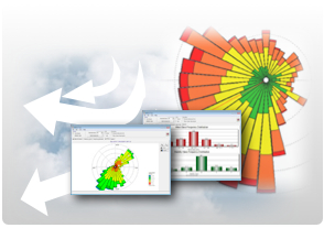 Lakes Environmental is pleased to announce the release of WRPLOT View version 6.5.1. Features available in this new version include:
- User Defined Wind Rose Scaling - Set the scale as a percentage or count of hours. Makes comparisons between wind roses easier. See this month's Modeling Tip below.
- Control of Wind Rose Petal Size – This allows greater flexibility in setting the appearance of the wind rose.
- Support for CALMET/CALPUFF Generic Met File Format – The CALMET/CALPUFF Generic surface data file format is now supported by WRPLOT View.
For a complete list of the changes and new features available in WRPLOT View version 6.5.1, please see our latest Release Notes.
WRPLOT View is provided by Lakes Environmental for FREE! Downloadyour copy today!